
Llamas in the Salar de Uyuni — see video here
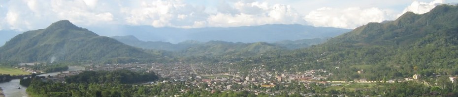
The empty desert plains of southwestern Bolivia are home to little more than mining sites and tiny groups of livestock herders grappling with the remoteness of the location and the harsh climate. In addition to being one of the rawest, most desolate regions I’ve traveled to, it was also one of the most incredibly scenic — the area features a diverse array of staggering natural beauty: snow-capped mountains, active volcanoes, geysers, algae-tinted lakes, vast salt flats, cacti forests, and more. Mine and Neil’s travels through the Bolivian Altiplano, and specifically the Salar de Uyuni, were the highlight of our recent Bolivia vacation.
 Volcano-created landscape |
 Vicuña carcass |
 Atop a rock formation near Arbol de Piedra |
 Beautiful, empty lagunas |
Slumdoggin’ It
On Mon. night, fresh off our survival of “Death Road”, we rushed back to La Paz to catch the Todo Turismo overnight bus to Uyuni, only to find it sold out. The next morning, we took a cheap ($3) commuter bus to get to the waypoint of Oruro, from where we knew there was a 3pm train leaving for Uyuni that day — and after that, not again for a while.
We arrived to find the train’s ticket station closed for lunch, not an encouraging sign given that many people had told us tickets often sold out well in advance of the day of. In fact, as we sat eating sandwiches across the street, another traveler came and told us she heard the train was sold out. Dispirited, we returned to the station to see for ourselves, and found to our surprise that the ticket counter had reopened early!

Not our train. (Photo credit: unknown)
Furthermore, the train had availability in one separate car for a 3rd class fare none of us even knew existed. Even if it were Slumdog Millionaire-style conditions, it was a miracle. And it was far from that — bench seating with little leg room, sure, but cheap — about $5 for an 8-hr ride over endless flat rolling plains. I passed the hours pleasantly reading, writing, chatting with the young Bolivian couple who sat facing us, and playing with their baby.
Around 11pm, we stepped off the train at Uyuni into the late night darkness, but instead of quiet, the streets and plazas were packed, with stages set up and bands playing. It was the night of Uyuni’s biggest festival of the year, and the locals were ready to drink and dance and set off firecrackers until the wee hours. Meanwhile, mindful we needed to get an early start in the morning, Neil and I tracked down a hostel with one available room. Despite the noise around us, we immediately passed out.
Into the Wild

Braving the biting wind outside our Land Cruiser at nearly 14,000ft up
Dozens of tour agencies line the streets of Uyuni looking to sell tourists on nearly identical trips out into the Salar. The morning after we arrived, we awoke early to hunt for one, settling on the well-regarded Oasis Tours. They agreed to my request, based on the recommendations of Lonely Planet and other tourists we had met, to do the “reverse tour” — starting from the south, at the Chilean border, and working our way back to Uyuni. It proved to be a great decision.
By 11am, we set off for the desert, Neil and I piled into a Toyota Land Cruiser along with three other Americans (health workers/educators working in Cochabamba) our guide, and cook. In a companion vehicle were a group of boisterous Brazilians and a cute French couple, who we joined up with for meals and lodging. As we sped out over wide-open desert, our guide mentioned to us that the area may host the 2014 Dakar Rally — well, it certainly seems like a fun spot to unleash ATVs!

Flamingos populate the high-altitude lagunas of the Altiplano
For now though, aside from the sparse settlements of livestock herders, this is mining country. We saw borax deposits everywhere, and later in the trip, our driver would indicate the direction of a brand new lithium plant whose inauguration President Evo Morales was attending that day. Unlike in Perú, which has been experiencing high-profile anti-mining protests, I was told the mining companies here generally have a good record. They provide good working conditions, and maintain the rudimentary dirt road “highway” that we were riding on in the direction of the Reserva Eduardo Avaroa national park.
We spent the first day driving toward the Chilean border, passing fields of vicuñas (wild relatives of the llama) at lower altitudes, the terrain becoming rockier and the wind more biting as we climbed. Along the way we passed a number of impressive volcanic rock formations, some which looked almost purposefully arranged Stonehenges, others from a distance looked like the outline of a downtown cityscape. At the highest altitudes, we were surprised to see lagunas replete with flamingos — and these were apparently thinned populations given that most, our guide explained, had already migrated for the season to Titicaca. For lunch and dinner we ate llama and that first night in a rudimentary lodge at about 4,500m (nearly 15,000ft) high, it was so cold that our little group of five slept in cots all crammed together, and I wore all my clothes, including knit cap, gloves, and woolen socks, inside of a sleeping bag, and covered myself in multiple blankets.

Just after sunrise at Laguna Verde
The next morning, we headed out at 5am in pitch black darkness. Dim starlight created inky black outlines of the mountains around us while the Toyota’s headlights revealed the few meters ahead of us of rocky volcanic terrain and scattered bits of ice and snow as we climbed to 4900m (16,000ft). “This is where they filmed the moon landing,” one of our companions had joked earlier, and it seemed very appropriate now. On our pre-dawn drive we passed through a field of geysers, marveling at the blasts of hot steam that punctured the cold air, while recoiling slightly at the strong smell of sulfur. We caught the sunrise from an impressive viewpoint straddling the view between the Laguna Blanca and the Laguna Verde. Shortly after, I couldn’t help but smile to see the group of young Brazilians, their first experience in cold weather, delightedly throwing fistfuls of snow into the air.
 Stripping in the freezing cold to enjoy the hot springs (worth it!) |
 Not Photoshop — algae gives the Laguna Colorado a crimson tint |
The second day was chock full of highlights. Arriving at a hot springs pool that morning, it seemed like insanity to strip off in the frigid cold, but we did, and it was amazingly invigorating experience. (It was also the closest I got to a bath in 4 days.) We later arrived at the Laguna Colorado, where algae and plankton give the lake its unique red hue. At the rock formations around the noted Arbol de Piedra (“Stone Tree”), a gust of wind knocked my camera over a ledge, where it crashed onto a rock face several feet below, and then fell another several feet into the sand. I thought that was the end of my new Canon, but it turned out that my tripod absorbed the first hard blow, and forty minutes worth of carefully picking sand out of my lens allowed the camera to turn on once again!
That night, back down at 3,600m outside the tiny village of San Juan de Rosario, we didn’t struggle with the cold. We were staying in a lodge where the walls were made entirely of salt — the bricks cut by chainsaw from the salt flats; the mortar wet, ground-up salt. I licked it, and yes, it was salty.
Fun With Distorted Perspectives

Overlooking the cacti forest from atop Isla Incahuasi

In dry season, the salt flats form (mostly) hexagonal tiles
Finally, on the third day it was time to see the main attraction, the Salar de Uyuni salt flats. Arriving there we were met by a surreal that Internet photos can’t prepare anyone for — it being the dry season here, the flats are one endless expanse of brilliant white stretching all the way out to the horizon. The Salar de Uyuni covers 12,000 sq km (roughly 4,500 sq miles) and is the world’s largest salt flat. In the heart of it lies a small “island” oasis, the Isla Incahuasi, which is covered by over 15,000 cacti, some of which are hundreds of years old. We passed the afternoon hiking up the isla’s hills and wandering across the white plains of hexagonal salt tiles around it.
One of the most popular activities for tourists at the salt flats takes advantage of the extreme flatness of the landscape — it enables one to take goofy photographs manipulating size and perspective. An Internet search will reveal a number of creative ideas; below are a few we took:
 Mmm, delicious! |
 Beer shower |
 Gulliver Jay, Lilliputian Neil |
 Genie in a Coke bottle |
The Train Cemetery

I climbed on top of an abandoned train in the middle of the desert
Our last stop on the tour was the Cementerio de Trenes (Train Cemetery), a collection of rusting vintage steam locomotives and rail cars outside of the town of Uyuni. It is a fantastic place for climbing, horseplay, and taking photos.
 Posing atop steel beams |
 The coolest swing set in the world |
La Vuelta
The return to La Paz was a lot less stressful than our adventure arriving to Uyuni. Before heading out onto the Salar, we had bought our tickets on the popular Omar bus line, paying roughly $17 for a decently warm bus with blankets. The only problem was that for the first eight or so hours we had to travel the notoriously bad road between Uyuni and Oruro, which lived up to its infamous reputation — our bus shook and rattled violently for hours over what felt like a minefield. It’s a testament to how tired we were that we still managed to sleep, albeit I woke up frequently to loud bumps. We arrived at La Paz bus terminal a little over 12 hours later.


Your salt flat pics are SO good.
French couple, huh? I dunno about that…
Yeah, sweet salt flat pics! I would love to browse some high-res versions of your various others too, if you feel like posting them.
Any particular reason the south-to-north version of the tour “proved to be a great decision”?
Flamingos. I did not expect Flamingos 🙂
Thanks Andrew! This being a public site I don’t include full-size images, but here is a link where you can browse a larger collection of my Salar photos in slightly less squint-inducing size: http://bit.ly/OlRgNe.
The reverse (“inversa“) tour is better because the vast majority of tour groups go north-to-south, so doing it the other way lets you avoid most of the crowds. It also allows you to spend the last day at the salt flats instead of the first, have more time there, and usually enjoy better lighting conditions. The only case where I wouldn’t recommend the reverse tour is for those who want to cross the Chilean border; there are some tourists who go north-to-south and don’t return to Uyuni, passing on to Chile at San Pedro de Atacama.
Cool, much appreciated! I’d ask if at some point you intersected with groups going the other way, but I s’pose it would’ve been on the road most of the time anyway.
One thing I forgot to mention is how strongly I remember Iceland’s Blue Lagoon, a 100% must-visit geothermal spa if you ever find yourself on that island, from when my family visited. It’s also filled with algae, but in that case it (obviously) comes out a vibrant blue. Awesome to see that a whole range of colored hot springs are available from Mother Nature, though selection may be limited by how many thousands of miles you’re willing to travel 🙂
cool stuff. seriously. i pride myself on a superficial knowledge of most every notable place on earth (joking), but had been unfamiliar with this part of bolivia til now.
great call wearing the bright shirt. i surmise you planned that out to impress (you know who) with your delectable photos.
these are probably some of the coolest photos that i’ve ever seen – very good work. did you ever find out why and how the train ended up being stranded/wrecked there? nice job forking neil, heh
Thanks, mate. The trains there are formerly derailed cars or those abandoned by mining companies many, many years ago.